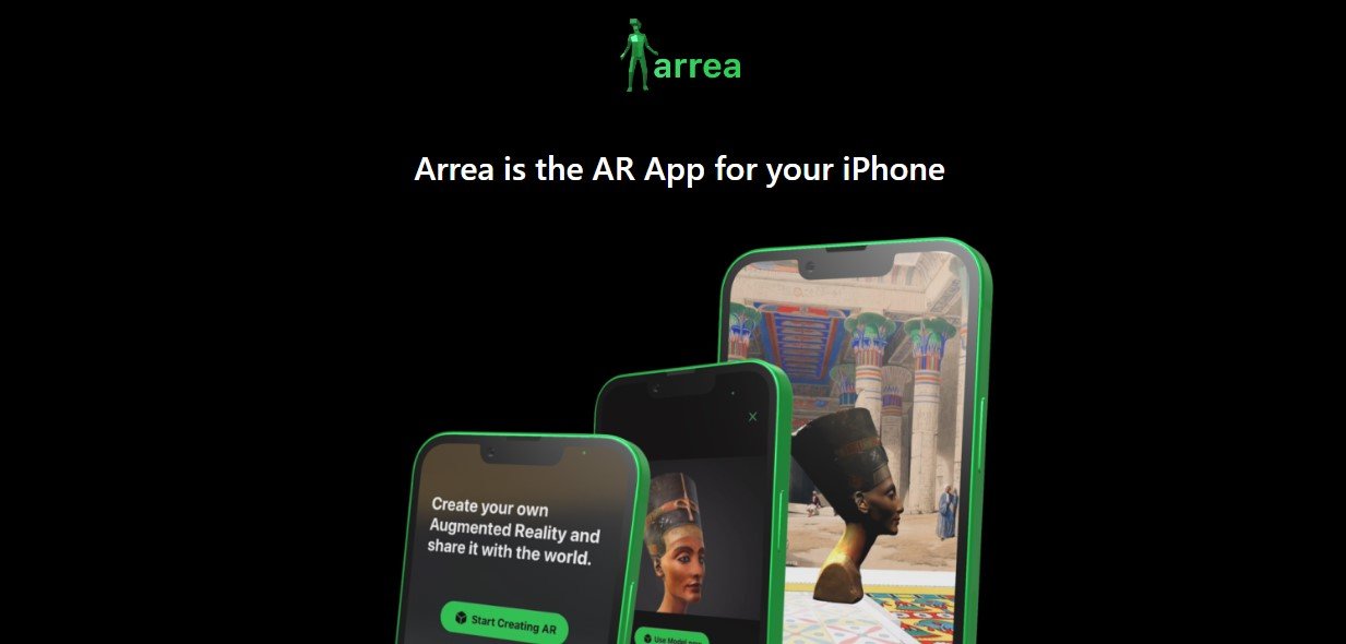
Arrea is an advanced AI-powered spatial intelligence platform designed to transform the way businesses, city planners, and real estate professionals analyze locations, optimize urban spaces, and make data-driven decisions. By leveraging machine learning, geospatial data, and predictive analytics, Arrea provides valuable insights for site selection, infrastructure planning, and real estate development.
With a focus on urban optimization, mobility trends, and location intelligence, Arrea helps organizations maximize efficiency, sustainability, and economic potential. Whether you are a city government, a retail chain, or a real estate investor, Arrea delivers actionable insights to enhance urban planning and business strategy.
Features
1. AI-Powered Location Analysis
- Evaluates demographics, foot traffic, and economic activityin any area
- Predicts growth trends and consumer behaviorusing machine learning
2. Smart Site Selection for Businesses
- Identifies optimal locationsfor new retail stores, offices, or facilities
- Analyzes competitor presence, accessibility, and demand patterns
3. Urban Planning & Infrastructure Optimization
- Provides real-time data on city infrastructure, transportation, and zoning
- Helps governments and planners design more sustainable cities
4. Predictive Analytics & Forecasting
- Uses AI to anticipate future population growth, economic shifts, and property value changes
- Supports long-term strategic planning
5. Mobility & Traffic Insights
- Monitors traffic flow, public transportation efficiency, and pedestrian movement
- Optimizes route planning and mobility infrastructure
6. Geospatial Data Visualization
- Interactive maps and heatmapsfor in-depth spatial analysis
- Visual representation of land use, customer density, and property trends
7. Climate & Environmental Impact Assessments
- Evaluates air quality, green space distribution, and sustainability metrics
- Helps cities develop eco-friendly and resilient urban spaces
8. Commercial & Real Estate Intelligence
- Tracks property trends, investment opportunities, and market fluctuations
- Provides insights for property developers and real estate investors
9. Smart City & IoT Integration
- Connects with urban sensors, IoT devices, and government data
- Enhances real-time decision-making for smart city initiatives
10. API & Data Integration
- Seamlessly integrates with GIS systems, business intelligence platforms, and urban databases
- Enables custom analytics and automated reporting
How It Works
1. Upload & Analyze Location Data
- Import geospatial, economic, and business datainto the Arrea platform
2. AI-Driven Insights & Predictions
- Machine learning algorithms analyze patterns and forecast trends
3. Visualize & Optimize Decision-Making
- Use heatmaps, dashboards, and spatial intelligence reportsto make informed choices
4. Implement & Monitor Results
- Continuously track urban development, mobility trends, and economic changes
Use Cases
1. City Governments & Urban Planners
- Optimize infrastructure, zoning, and public transportation systems
- Use AI to design sustainable, smart cities
2. Real Estate Developers & Investors
- Identify profitable locations for new developments
- Analyze property value trends and market demand
3. Retail & Hospitality Businesses
- Find high-traffic locationsfor stores, restaurants, and hotels
- Predict customer behavior and revenue potential
4. Transportation & Mobility Providers
- Improve traffic management, transit planning, and ride-sharing efficiency
- Enhance public transport accessibility
5. Environmental & Climate Agencies
- Monitor climate impact, pollution levels, and green space allocation
- Develop sustainable urban solutions
6. Financial & Investment Firms
- Use spatial intelligence to assess economic risks and opportunities
- Evaluate commercial real estate investments
Pricing
Arrea offers custom pricing based on the size and scope of the project.
1. Starter Plan (For Small Businesses & Startups)
- Access to basic location intelligence tools
- Limited AI predictions and reports
2. Business Plan (For Enterprises & Government Agencies)
- Full access to AI analytics, predictive modeling, and geospatial mapping
- Integration with existing urban planning or business intelligence software
3. Enterprise Plan (For Large-Scale Smart City Initiatives)
- Advanced real-time data tracking, mobility insights, and API access
- Dedicated support and custom implementation
For detailed pricing, visit the Arrea Pricing Page.
Strengths
- AI-Powered Spatial Intelligencefor smarter decision-making
- Real-Time Data & Predictive Analyticsto anticipate urban trends
- Seamless Integrationwith GIS, IoT, and smart city platforms
- Actionable Insights for Businesses & Governments
- Scalable for Small Businesses to Large Smart Cities
Drawbacks
- Custom Pricing Modelmay not be accessible for small businesses
- Complex Data Requirementsfor full functionality
- Requires GIS or Urban Planning Expertisefor advanced use cases
Comparison with Other Tools
Arrea vs. Esri ArcGIS
- Arrea provides AI-driven insights and automation
- ArcGIS is a traditional GIS tool focused on spatial data visualization
Arrea vs. Google Earth Engine
- Arrea specializes in urban planning and business intelligence
- Google Earth Engine is more focused on satellite imagery and environmental analysis
Arrea vs. CARTO
- Arrea has AI-powered forecasting and site selection tools
- CARTO focuses on geospatial visualization and mapping
Customer Reviews and Testimonials
Positive Feedback
- Arrea helped our city optimize public transportation routes, reducing congestion – Urban Planner
- The AI-powered site selection toolsaved us thousands in real estate investments – Retail Expansion Manager
Constructive Criticism
- More third-party integrationswould make Arrea even more powerful – GIS Analyst
- The learning curve is steepfor non-technical users – Real Estate Developer
Conclusion
Arrea is a cutting-edge AI-driven spatial intelligence platform that empowers businesses, governments, and urban planners with real-time geospatial analytics, predictive modeling, and smart decision-making tools. Whether optimizing city infrastructure, selecting retail locations, or analyzing real estate trends, Arrea provides data-driven insights for smarter urban and business development.
From smart cities to commercial site selection, Arrea transforms spatial data into actionable intelligence, helping organizations make faster, more informed decisions.
Ready to revolutionize your location strategy? Visit Arrea today.